Bangalore Maps and Orientation
(Bangalore, Karnataka, India)
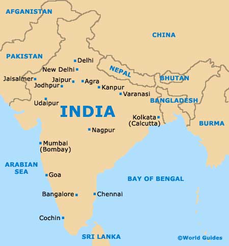
Bangalore is an enormous city, with a population of more than seven million inhabitants. The capital of the country's Karnataka state, Bangalore lies in south-eastern India and within the Mysore Plateau region. Many large man-made lakes surround much of Bangalore and supply the city with water, with the northerly Hebbal Lake being especially large and notable.
The numerous tourist offices around Bangalore all supply good maps of the city, free of charge. This enables you to find your way around with relative ease, although if you would like a more detailed map, then the downtown bookstores located along MG Road and Church Street will be sure to meet your needs.
Maps and Orientation of the City
Urban Bangalore can be split into three main regions, the north, the south, and also the Anekal district, which is located to the far south of the city centre and within the metropolitan area. Within central Bangalore, the main bus and train stations are easy to find and located on the outskirts of the Gandhi Nagar district, being close to plenty of shops, restaurants, cinemas and cheap accommodation.
Those looking for historical remains in Bangalore will need to head to the southern side of the City Market, where many grand residences stand on wide tree-lined boulevards. This area is on the northern side of Cubbon Park, an important local landmark in Bangalore where many of the main tourist attractions reside.
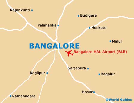
- Bagalur - south-east
- Dodaballapur - north
- Hoskote - north-east
- Hosur - south-east
- Kaglipur - south
- Kambiganhalli - north-east
- Kolar - north-east
- Malur - east
- Nelamangala - north-west
- Ramanagara - south-west
- Tumkur - north-west
- Yelahanka - north
Map of India
Map of Bangalore